
Berkas:1814 Thomson Map of the West Indies ^ Central America - Geographicus - WestIndies-t-1814.jpg
Ukuran pratayang ini: 711 × 599 piksel. Resolusi lainnya: 285 × 240 piksel | 569 × 480 piksel | 911 × 768 piksel | 1.215 × 1.024 piksel | 2.430 × 2.048 piksel | 5.000 × 4.215 piksel.
Ukuran asli (5.000 × 4.215 piksel, ukuran berkas: 4,41 MB, tipe MIME: image/jpeg)
| John Thomson: West Indies.
( |
||||||||||||||
|---|---|---|---|---|---|---|---|---|---|---|---|---|---|---|
| Seniman/Pembuat |
|
|||||||||||||
| Judul |
West Indies. |
|||||||||||||
| Deskripsi |
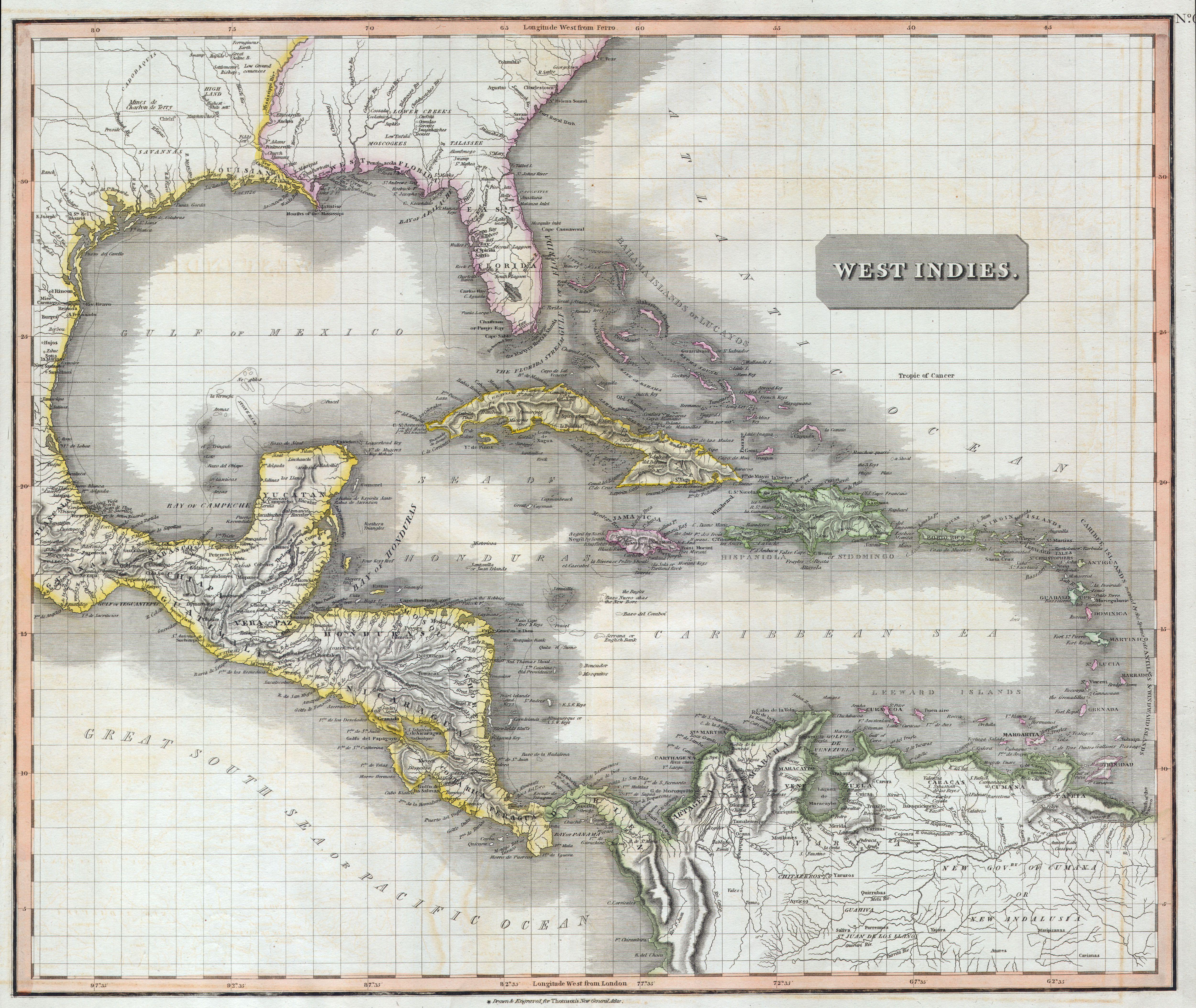
English: A masterpiece. This fascinating hand colored 1814 map by Edinburgh cartographer John Thomson depicts the West Indies and Central America. Covers from the Carolinas south through Texas, Mexico and central America to the northern part of South America as far as Venezuela and the Orinoco Delta. Includes all of the West Indies islands including the Caribbean and the Greater and Lesser Antilles. Extraordinarily details with notations on both physical and political features, as well as undersea elements, banks, and shoals. Notates several American Indian tribes in both North and South America. This map’s magnificent size, beautiful color, and high detail make this one of the finest maps of this region to appear in the early 19th century. |
|||||||||||||
| Tanggal | 1814 | |||||||||||||
| Ukuran | Tinggi: 20 in (50,8 cm); lebar: 24 in (60,9 cm) | |||||||||||||
| Kode inventaris |
Geographicus link: WestIndies-t-1814 |
|||||||||||||
| Sumber/Fotografer |
|
|||||||||||||
| Izin (Menggunakan kembali berkas ini) |
|
|||||||||||||
Riwayat berkas
Klik pada tanggal/waktu untuk melihat berkas ini pada saat tersebut.
| Tanggal/Waktu | Miniatur | Dimensi | Pengguna | Komentar | |
|---|---|---|---|---|---|
| terkini | 24 Maret 2011 12.01 | | 5.000 × 4.215 (4,41 MB) | BotMultichillT | {{subst:User:Multichill/Geographicus |link=http://www.geographicus.com/P/AntiqueMap/WestIndies-t-1814 |product_name=1814 Thomson Map of the West Indies & Central America |map_title=West Indies. |description=A masterpiece. This fascinating hand colored 181 |
Penggunaan berkas
Halaman berikut menggunakan berkas ini:
Penggunaan berkas global
Wiki lain berikut menggunakan berkas ini:
- Penggunaan pada en.wikipedia.org
- Penggunaan pada es.wikipedia.org
- Penggunaan pada ru.wikipedia.org
- Penggunaan pada sh.wikipedia.org
- Penggunaan pada uk.wikipedia.org