
Berkas:1771 Rizzi-Zannoni Map of Germany and Poland - Geographicus - GermanyNW-zannoni-1771.jpg
Ukuran pratayang ini: 800 × 560 piksel. Resolusi lainnya: 320 × 224 piksel | 640 × 448 piksel | 1.024 × 717 piksel | 1.280 × 896 piksel | 2.560 × 1.792 piksel | 3.500 × 2.450 piksel.
Ukuran asli (3.500 × 2.450 piksel, ukuran berkas: 3,04 MB, tipe MIME: image/jpeg)
Ringkasan
| L'Alemagne Divisee par Cercles. | ||||||
|---|---|---|---|---|---|---|
| Seniman/Pembuat | ||||||
| Judul |
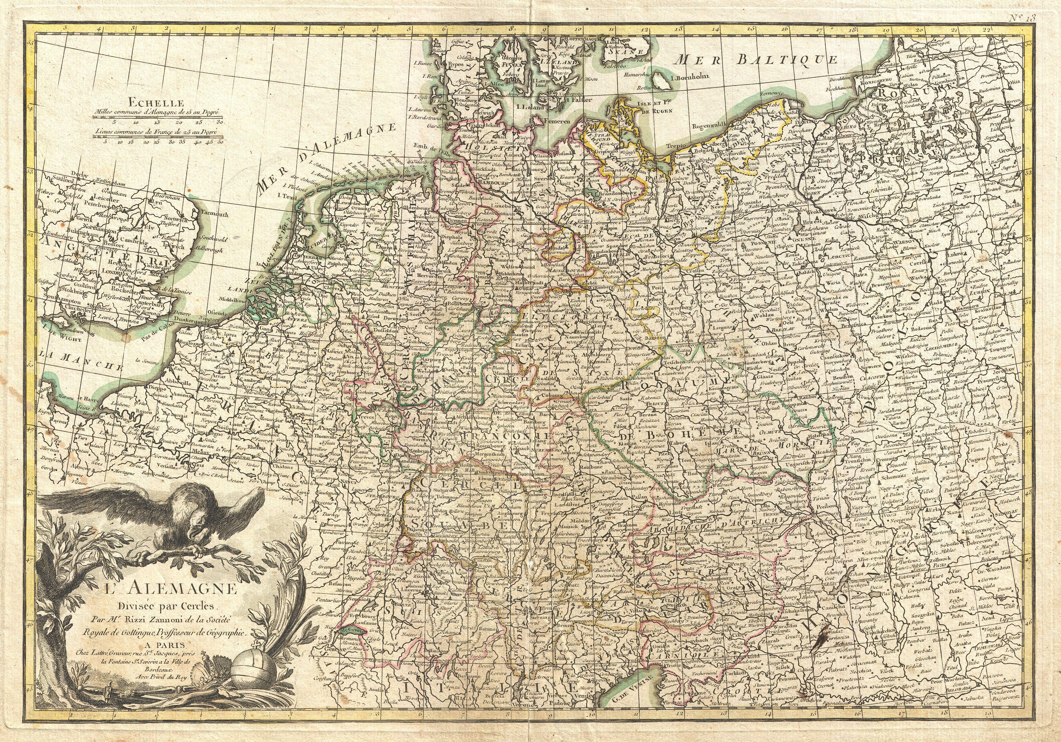
L'Alemagne Divisee par Cercles. |
|||||
| Deskripsi |
English: A beautiful example of Rizzi-Zannoni's decorative map of Germany. Covers from Jutland to the Gulf of Venice and from England to Poland.. Offers excellent detail throughout showing mountains, rivers, forests, national boundaries, regional boundaries, forts, and cities. A large decorative title cartouche depicting the Eagle of Deutschland appears in the lower left quadrant. Drawn by Rizzi-Zannon in 1762 for issue as plate no. 13 in Jean Lattre's 1776 edition of the Atlas Moderne . |
|||||
| Tanggal | 1771 (undated) | |||||
| Ukuran | Tinggi: 12,5 in (31,7 cm); lebar: 17,5 in (44,4 cm) | |||||
| Kode inventaris |
Geographicus link: GermanyNW-zannoni-1771 |
|||||
| Sumber/Fotografer |
Lattre, Jean, Atlas Moderne ou Collection de Cartes sur Toutes les Parties du Globe Terrestre, c. 1775.
|
|||||
| Izin (Menggunakan kembali berkas ini) |
|
|||||
Riwayat berkas
Klik pada tanggal/waktu untuk melihat berkas ini pada saat tersebut.
| Tanggal/Waktu | Miniatur | Dimensi | Pengguna | Komentar | |
|---|---|---|---|---|---|
| terkini | 23 Maret 2011 17.57 | | 3.500 × 2.450 (3,04 MB) | BotMultichillT | {{subst:User:Multichill/Geographicus |link=http://www.geographicus.com/P/AntiqueMap/GermanyNW-zannoni-1771 |product_name=1771 Rizzi-Zannoni Map of Germany and Poland |map_title=L'Alemagne Divisee par Cercles. |description=A beautiful example of Rizzi-Zann |
Penggunaan berkas
Halaman berikut menggunakan berkas ini:
Penggunaan berkas global
Wiki lain berikut menggunakan berkas ini:
- Penggunaan pada fr.wikipedia.org
- Penggunaan pada lt.wikibooks.org